Monday, 23 November 2009

A walk around Adelaide- continued.

The University is built on a series of terraces descending from North Terrace towards the River Torrens. Passing by the side of the Elder Hall, we come to a court with a pond and the popular statue of Confucius. Chinese students make a point of being photographed here on their graduation day.
We then come to the University Plaza, a pleasant open space surrounded by services such as the bank, the accommodation service, the university health service and so on. It is not to remain long. There are plans afoot for a huge Learning Resources centre that will cover it completely. From this it may be seen that Adelaide, too, has a university administration.

Descending steps, we come to Engineering South

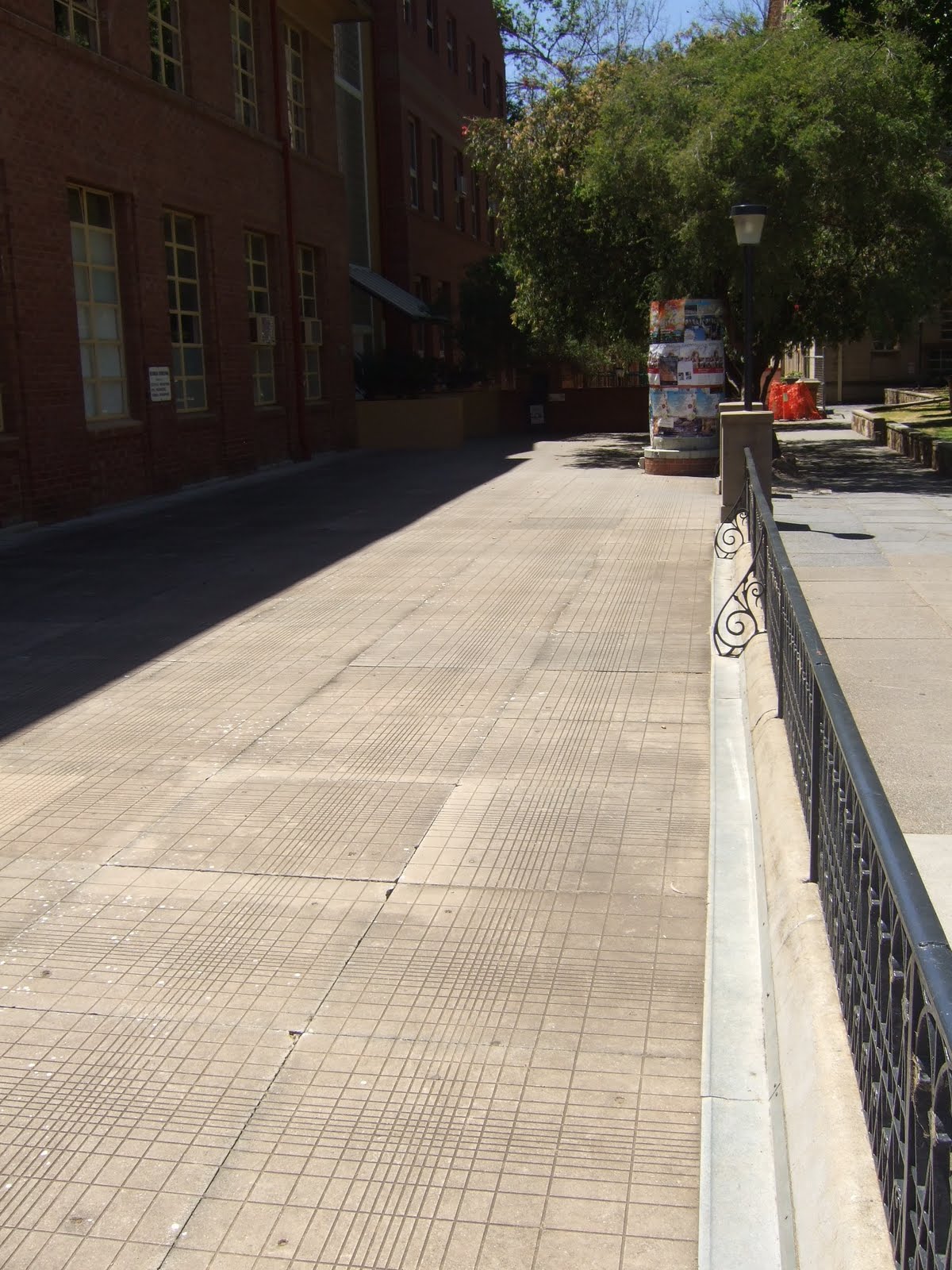
which is the only building I know of to boast logarithmic paving slabs,


and Engineering North, which is where I work.

Continuing downward, we pass this courtyard that accommodates the Student Union building and the University Library (behind the camera)

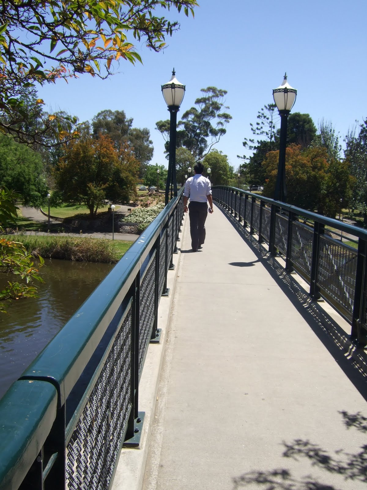
We can then cross the Torrens by the University Bridge


commanding good views of the river,


and so homeward. This is O'Connell Street, the main shopping street of North Adelaide, home to a cinema, a shopping centre and many restaurants that we'll miss.

This is Melbourne street, rather closer to home. Again, there are many shops and restaurants here.
Finally we turn on to Jerningham street, which takes us back to Finniss Street (to the right in front of the block of flats.)


A walk around Adelaide

In many ways, things here are drawing rapidly to a close. We have now vacated our apartment and are back in Kathleen Lumley College. I propose to post a couple of blogs today showing the scenery as one walks into Adelaide from where we live, followed by another on the subject of our last weekend's trip to Melbourne. We shall then be off to New Zealand.

Behind the tree is the entrance to Mattanya, where we were living.

From there we look along Finniss Street.

Walking along Finniss Street, we pass our local, the British. It serves a decent pint (or schooner) and does good meals.

At the end of Finniss Street one comes to Frome Road. This is looking North towards North Adelaide village.

However, we cross Frome Road and pass the hospital

walking west through some rather nice parkland

and join King William Street. This crosses North Terrace and the residence of the Governor of South Australia is on the corner. I should really have included a view of the State Parliament, too.


Crossing North Terrace, we follow King William Street south. The tram to Glenelg can be seen here.

Turning left, we enter Rundle Mall. This is one of the principal Adelaide shopping streets.


Turning left from Rundle Mall, we re-enter North Terrace opposite the War Memorial. There is a series of public buildings as we walk east along North Terrace.

They start with the State Library

continuing with the South Australia Museum


the Art Gallery
and the Elder Hall, where a lot of the concerts take place.

Final view looking east along North Terrace towards the Adelaide Hills.


Sunday, 8 November 2009

Flinders Ranges 4- the return

The return path took us back to Quorn once more. There was some delay here and we quickly demonstrated how quickly, for an international group, we had learned some basic lessons, like finding a place in the shade and sitting down.

There was time for another look at the old station
And to read some of the material about the old railway.


We also visited a nice town called Melrose. It is the centre of a network of cycling tracks and is a very popular tourist destination for this and other reasons. One thing it features is an old forge converted into a most tempting coffee-and-baking shop.

The gardens at the back are shady and extensive. The seating is comfortable.


There's enough to see that one can wander about while waiting.

Final group photo.


One final sight well worth seeing in Melrose is the style of the accommodation units that the hotel has installed. The truck cabs seem to be absolutely real- I wonder what clientele they are supposed to appeal to?

After this, we returned by the Clare Valley and a number of wineries and cellar doors. By the third (a Jesuit foundation) even I missed out on the sampling and had a look at the church instead. South Australia produces about 80% of the country's wine exports in the Clare and Barossa valleys, the Adelaide Hills and Coonawarra. Unlike the Coonawarra operation we had seen, most of the wineries here were really rather small-scale and concentrate on the quality end of the market.
Incidentally, the word on Jacob's Creek is that it is "The Fosters of Australian Wine." I think that is intended to mean that the bulk of production is consumed abroad rather than at home.
No more here. There will be a further blog on the general photos of Adelaide and the University that I've been taking over the past week. Then the trip to New Zealand- any further blogging will be done from home.


Friday, 6 November 2009

Flinders Ranges-3

After leaving the airstrip, we headed to Wilpena Gap, the only practicable route between inside and outside the Pound. This is one reason why the Pound was considered good stock country- only one means of entrance and exit had to be patrolled. There is a visitor centre there.

The local trees are mainly redgums. They seem to have a fantastic capacity for regeneration, even when they are so rotten as to be completely hollow. Gums anyway shed limbs naturally with great ease- the advice is not to go to sleep in the shade of a gum.

The upper branches are usually very pretty.

We headed off along the tourist track into the Pound

Seeing numerous kangaroos, this family of emus

and this rather antediluvian-looking lizard.

After a climb that was rather knackering in the temperature (by now 38 Celsius) we got to the top of a low hill with this panoramic view over the inside of the Pound.


We next got back in the bus and headed North to the Bunyaroo and Brachina gorges through the Heysen mountains. This is looking down into the Bunyaroo gorge. The road we followed to get down can just be seen in the distance.


Many examples of extreme folding of strata, leading to nearly vertical rock bands on the hills, can be seen once on the bottom of the gorge. This is the effect of the crustal upthrust mentioned in the last posting.

The strata here are more horizontal. The changes in conditions of the sea that laid these strata results in alternate hard and soft bands that weather into what looks like ornamental brickwork.


We followed into the Brachina Gorge. There was the occasional heat-dazed kangaroo,

But what we were after was the yellow-footed rock wallaby. They had too much sense to be out under these conditions! So the nearest we got was this rather amateurish sculpture at Quorn.


Outside the Brachina Gorge, we debouched into a stretch of much less lush outback country. This still doesn't qualify as "desert".

We made it onto the tarmaced road north to Parachilna. What is it about a pub sign that makes thirsty people stop the bus, get out and photograph it, instead of doing what it says and rushing on to the pub? This place is famous as a bush-tucker restaurant and I'm told that people will drive up from Adelaide purely to eat there, difficult though this is to believe. We didn't sample the kangaroo and emu steaks, etc. The female members of the party had the bush-fruit ice creams while we others satisfied ourselves with Fargher Lager, which has rather more body than Fosters.
Readers will be relieved to know that we turned back at this point and didn't go to the next gorge north, intriguingly known as Mount Buggery Gorge.


Even with the above refreshment, the pool back at Rawnsley was very welcome.


Thursday, 5 November 2009

Flinders Ranges- 2

As revealed at the end of our last posting, we opted to go on the aerial sightseeing flight. Accordingly, we were up bright and early and were checked in at Rawnsley Station International by 7.30 am.
Taking off, we contrived to scatter some of the remaining sheep stock of Rawnsley Park.


The morning was clear and still and we got some spectacular views of the mural crags of Wilpena Pound on the way up.

This is the Elder Ranges- we headed first over there to get a run-in for the traditional picture of the Pound. About the Flinders- there are some pretty old rocks around here. Old rocks are nothing unusual in Australia, where it is possible in places to walk on the original surface of Pangaea. The picture is of a range of Himalayan proportions that has eroded down to sea level over the years. This has then been raised by crustal compression mechanisms, as can be seen here. Wilpena Pound itself is the not-quite obliterated remains of one of the bigger mountains. It contains the highest point of the Flinders, St Mary's Peak. The local rocks give their name to a geological period, the Ediacaran. This lasted from 635 to 542 million years ago and contains the earliest traces of multicelled animals- the ancestors of soft corals, jellyfish and trilobites (and one which is claimed to be chordate, perhaps the ancestor of us all.) They're not strictly fossils because these things had no bones- more the preserved impressions that they left in the sea bed. Needless to say, being Australia, the whole area is infested with mineral deposits and was exploited very early in settlement. The copper (etc.) was originally moved out by bullock cart and then the railway, which was built partly for that purpose.


And the "traditional" tourist view of the Pound. The Indigenous dreamtime story is that the Pound is the remains of two colossal serpents that ate up most of the people at an initiation, then lay head-to-tail and died. St Mary's Peak is one of their heads; there is a lower peak at the other side that is the head of the other serpent. The Heysen ranges (below) are the tracks they made in coming to the site.
Flying by the side of the Pound......


The Heysen Ranges. They certainly do look like a snake-track, I think.

It was so calm that we could fly over the Pound. Not usually possible because of thermals.


The Pound was a stock station for a short time. Now, vehicular access is prohibited, all the stock has been moved out and it's reverting to natural bush. There are walking tracks but walkers are encouraged to stick to them. It's quite well watered because of its bowl shape.


Airborne, one loses any sense of direction quite quickly. This _could_ be the ABC range (the people who named it stopped counting at 26, but there's more like 200 separate peaks.) However, this information doesn't come with a guarantee.


St Mary's Peak. This is, I think, as good a view as could be got, with the Pound behind it.
As you'll gather, the landing was as successful as the take-off.
Next- the day's activities.