 As revealed at the end of our last posting, we opted to go on the aerial sightseeing flight. Accordingly, we were up bright and early and were checked in at Rawnsley Station International by 7.30 am.
 Taking off, we contrived to scatter some of the remaining sheep stock of Rawnsley Park.
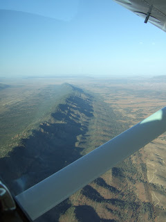
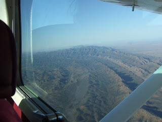
The morning was clear and still and we got some spectacular views of the mural crags of Wilpena Pound on the way up.
 This is the Elder Ranges- we headed first over there to get a run-in for the traditional picture of the Pound. About the Flinders- there are some pretty old rocks around here. Old rocks are nothing unusual in Australia, where it is possible in places to walk on the original surface of Pangaea. The picture is of a range of Himalayan proportions that has eroded down to sea level over the years. This has then been raised by crustal compression mechanisms, as can be seen here. Wilpena Pound itself is the not-quite obliterated remains of one of the bigger mountains. It contains the highest point of the Flinders, St Mary's Peak. The local rocks give their name to a geological period, the Ediacaran. This lasted from 635 to 542 million years ago and contains the earliest traces of multicelled animals- the ancestors of soft corals, jellyfish and trilobites (and one which is claimed to be chordate, perhaps the ancestor of us all.) They're not strictly fossils because these things had no bones- more the preserved impressions that they left in the sea bed. Needless to say, being Australia, the whole area is infested with mineral deposits and was exploited very early in settlement. The copper (etc.) was originally moved out by bullock cart and then the railway, which was built partly for that purpose.
And the "traditional" tourist view of the Pound. The Indigenous dreamtime story is that the Pound is the remains of two colossal serpents that ate up most of the people at an initiation, then lay head-to-tail and died. St Mary's Peak is one of their heads; there is a lower peak at the other side that is the head of the other serpent. The Heysen ranges (below) are the tracks they made in coming to the site.
 Flying by the side of the Pound......
 The Heysen Ranges. They certainly do look like a snake-track, I think.
 It was so calm that we could fly over the Pound. Not usually possible because of thermals.
The Pound was a stock station for a short time. Now, vehicular access is prohibited, all the stock has been moved out and it's reverting to natural bush. There are walking tracks but walkers are encouraged to stick to them. It's quite well watered because of its bowl shape.

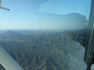
Airborne, one loses any sense of direction quite quickly. This _could_ be the ABC range (the people who named it stopped counting at 26, but there's more like 200 separate peaks.) However, this information doesn't come with a guarantee.
As you'll gather, the landing was as successful as the take-off.
Next- the day's activities.


Naomi here. You seem to be having a fantastic time. Super to see the photos of Stephen and Co. Your photos are all brilliant. It is wonderful to see all your different trips.
ReplyDelete