Thursday, 5 November 2009

Flinders Ranges- 2

As revealed at the end of our last posting, we opted to go on the aerial sightseeing flight. Accordingly, we were up bright and early and were checked in at Rawnsley Station International by 7.30 am.
Taking off, we contrived to scatter some of the remaining sheep stock of Rawnsley Park.


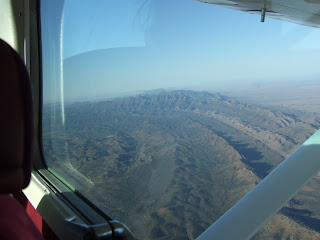
The morning was clear and still and we got some spectacular views of the mural crags of Wilpena Pound on the way up.
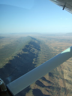
This is the Elder Ranges- we headed first over there to get a run-in for the traditional picture of the Pound. About the Flinders- there are some pretty old rocks around here. Old rocks are nothing unusual in Australia, where it is possible in places to walk on the original surface of Pangaea. The picture is of a range of Himalayan proportions that has eroded down to sea level over the years. This has then been raised by crustal compression mechanisms, as can be seen here. Wilpena Pound itself is the not-quite obliterated remains of one of the bigger mountains. It contains the highest point of the Flinders, St Mary's Peak. The local rocks give their name to a geological period, the Ediacaran. This lasted from 635 to 542 million years ago and contains the earliest traces of multicelled animals- the ancestors of soft corals, jellyfish and trilobites (and one which is claimed to be chordate, perhaps the ancestor of us all.) They're not strictly fossils because these things had no bones- more the preserved impressions that they left in the sea bed. Needless to say, being Australia, the whole area is infested with mineral deposits and was exploited very early in settlement. The copper (etc.) was originally moved out by bullock cart and then the railway, which was built partly for that purpose.


And the "traditional" tourist view of the Pound. The Indigenous dreamtime story is that the Pound is the remains of two colossal serpents that ate up most of the people at an initiation, then lay head-to-tail and died. St Mary's Peak is one of their heads; there is a lower peak at the other side that is the head of the other serpent. The Heysen ranges (below) are the tracks they made in coming to the site.
Flying by the side of the Pound......


The Heysen Ranges. They certainly do look like a snake-track, I think.

It was so calm that we could fly over the Pound. Not usually possible because of thermals.


The Pound was a stock station for a short time. Now, vehicular access is prohibited, all the stock has been moved out and it's reverting to natural bush. There are walking tracks but walkers are encouraged to stick to them. It's quite well watered because of its bowl shape.
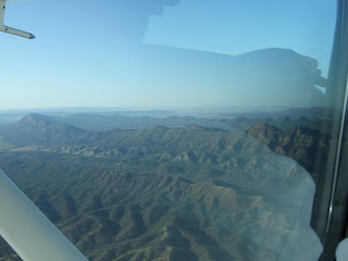


Airborne, one loses any sense of direction quite quickly. This _could_ be the ABC range (the people who named it stopped counting at 26, but there's more like 200 separate peaks.) However, this information doesn't come with a guarantee.


St Mary's Peak. This is, I think, as good a view as could be got, with the Pound behind it.
As you'll gather, the landing was as successful as the take-off.
Next- the day's activities.


Tuesday, 3 November 2009

Flinders Ranges 1

Last weekend was our long-awaited trip to the Flinders ranges. We covered the same route as on the tour with the students earlier on as far as Port Augusta.
The vehicle was christened the "Desert Dog." It's basically a minibus with stiff, long-stroke shock absorbers, an extra dust filter on the engine, a tank of chilled water ("Eski" ) in the back and (thank goodness) effective air-conditioning.

We called in at Port Germein on the way. This was the longest wooden pier in the southern hemisphere and was used for loading grain onto sailing ships. Some of the 1.6 km was washed away a few years ago, but it's still quite impressive. The moisture in the air was very welcome in view of what was to come.


From Port Augusta we followed the Pitchi Ritchi Pass along the line of the original 'Ghan railway (it goes slightly to the west of this now.)

And passed by the old Quorn Station.

We first looked at the old Kanyaka homestead. This is north of the Goyder Line, mapped out by a surveyor of that name in 1865. He maintained that, based on rainfall and soil quality, agriculture was only possible to the south of the line. However, rainfall in the late 1860s and 1870s was uncharacteristically heavy. British settlers with more money than sense were attracted to try their luck as agriculturalists. Most of them had visions of being squirearchs and local dignitaries. Nearly all of these settlements failed when the climate returned to normal and many fortunes were lost. This is one that went sooner than many, and the extravagant style of the buildings gives an indication of why so many fortunes were lost in that period.


We next visited the Aboriginal cave paintings at Yorrambulla Caves. It's well provided with scaffolding for access- originally it was a bit of a scramble.


No, we're not in mourning. The fly veils aren't essential for walking in the outback summer, but they do allow you to concentrate on the scenery and not on keeping the flies out of your mouth and nose! Great kit, by the way- the shirt and trousers are fancy new textile that wicks away the sweat. They work, too. Bone dry except for beneath the rucksack.


The site was used for initiation ceremonies. At puberty the young men were driven out of the community and only allowed back in after a good deal of instruction and testing, culminating in an initiation ceremony in which they were scared out of their wits. Seems like an idea that could profitably be copied even now. Yorrambulla means "Two Blokes" and refers to a vertically stratified hill with two rock outcrops at the top. The double arrows represent kangaroo tracks and refer to what was cooked at the ceremony (the hearths are the circles of dots with food symbols in the centre.) Other symbols (not shown here) are lines that depict the paths followed by the male dancers, singing seated women and various other features of the ceremony. There are still people of the local tribe around and, indeed, we met one of them, who introduced us to the local constellations and their European and Indigenous meanings. But they don't say everything about their cermonies.

After leaving the caves, we finally saw the mountains of the Wilpena Pound sanctuary in the distance.

Because of the hills (highest in the Flinders) the area around Wilpena is relatively verdant.

We stayed at a sheep station called Rawnsley Park. The owners have run the stock levels down to "sentimental" levels and make most of their income from tourism.


Disgracefully, we ourselves opted for a cabin with a comfortable bedroom, kitchen, shower and air conditioning. Serves me right- it evidently wasn't mozzie-proof and I suffered on the second night. I'm still carrying the marks. As always, I was bitten multiple times and Liz, beside me, wasn't touched. Nor will she be as long as I'm there.


The alternatives were, on the expensive side, "Eco-villas" made of adobe-covered compressed straw bales and polished hardwood floors, with all mod cons including complimentary drinks and a roof that rolls back at the flick of a switch so one can see the stars from in bed. On the cheaper side, some camped (the tents were, I'm told, quite comfortable), two slept out under the stars in swags and were bitten even more than me and most opted for the bunkhouses.


These were comfortable (again, I'm told) but not air conditioned. We ate out round these tables under the stars. Food was mostly barbecued meat and salad and was of very good standard. The drinks were pre-purchased at the nearest pub, in Hawker.
By this time, we had decided to take the opportunity of the scenic flight over Wilpena, even though departure was at 0730. This contributed to the ridiculous number of photographs we took and is the main reason for splitting this blog into three parts. More tomorrow, or whenever I can make it.


Monday, 26 October 2009

Goolwa weekend

Hello again, after rather a long break. Last weekend we went down to Goolwa, not far from Victor Harbor. However, while Victor Harbor is very much on the ocean, Goolwa marks the boundary between the ocean and the wetlands where the Murray River flows into the sea. It was originally founded as a port to handle the transfer of goods between ocean-going ships and the river craft that would carry them far up the river. The Murray and its tributary the Darling arise in the mountains to the east, in Victoria and New South Wales, and provides irrigation and formerly transport to the huge area between there and Adelaide. It is also one of the sources of Adelaide's water supply. Consequently, there is almost no aspect of its management that is not controversial. Goolwa was an amazingly active shipyard for river steamers in its day. Later, the construction of a railway that bypassed it cut off much of its trade. But it's still a pleasant small town with most civic facilities, increasingly used by tourist traffic.
We were fortunate to be offered the use of his house on the dunes in Goolwa by Brian O'Neill, a colleague in the Adelaide department. Much of the water-front is taken up by new tourist and second homes constuction.

This is the historic wharf area. The train is the "Cockle Train", that runs a scenic route between Goolwa and Victor Harbor. We didn't get up early enough to catch it.....


There is a bridge from Goolwa to Hindmarsh Island, one of those that separates Lake Alexandrina, the final stage of the Murray's meanderings, from the sea. This is from the island side. We walked over and nearly froze. Leaving Adelaide in brilliant sunshine, we neglected to bring sufficiently warm clothes or waterproofs. Home is going to bring a great revision of our habits!


This is the beach, looking over to Victor Harbor in the far distance. As the land thereabouts is fairly flat and alluvial, the dunes assume an almost Netherlands significance.


Liz on the beach. The shades were a little excessive, in my view- it was overcast and distincly cold.


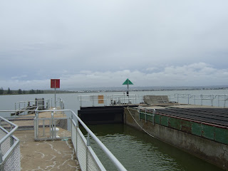
This is the lock in the barrage from the ocean spit to Hindmarsh Island that separates the sea from the freshwater environment. Use of Murray water for farming and idrinking water has reduced the flow at the mouth to 27% or less of its original value. A series of barrages, not just this one, were constructed in the 1930s to prevent the lakes from suffering salinification. The actual Murray mouth is still open, but shifts in position at an almost perceptible rate by build-up of sandbars. Lately, there have been further problems with Lake Alexandrina. Lowering of the level due to drought and over-use of water has exposed sediments to the atmosphere and these are leaching into the lake and reducing its pH. This is being addressed in a way rather similar to the Aral Sea- a barrage is being constructed between the upper and lower lakes, with a view to preserving a habitat for local species at least in the upper portion. I'm not sure what will happen to the lower portion.

This is me looking over the channel between the spit and the island. It is downstream of the barrage, therefore saltwater and properly a part of the Coorong.


And this is typical Coorong terrain.


Plenty of bird life, including pelicans

Black swans


Egrets

And the first Australian Ibis I've seen so far south. They're very common in Queensland, there they scavenge garbage. But these seem still to do their thing in the shallow water.


On the way back we had a walk at a place called Currency Creek. It doesn't look much from the road, but once one goes underneath the viaduct it is unexpectedly pretty.


The entrance to a disused copper mine


It ends in a rocky pool with a small waterfall. Idyllic. This is a rather poor picture that contrives to omit the waterfall.


And another rather poor picture.
Next weekend- an outback safari, visit to Wilpena pound (huge natural amphitheatre in the Flinders ranges), various gorge walks, sleeping under the stars for those who like it
(we're in a lodge room, thank you very much) and a visit to the Clare Valley winery area first-to dull the senses? We shall see.


Saturday, 3 October 2009

Kangaroo Island

As this week was the mid-semester break and Liz was still away, I decided to book for a two-day trip to Kangaroo Island. This is reached from Cape Jervis, about 100km SW of Adelaide. The strait is called "Backstairs Passage" and is about 12km at its narrowest. This is twice the distance a bee can fly and KI is now a recognised mite-free reservoir of Ligurian bees that were introduced in the 19th century. Beekeeping is a big business on the island.
The ferry service is a pretty regular one.


It gets in at Penneshaw, one of two substantial towns. The other is Kingscote, the "capital" of the island (i.e. it has the school, the police station, the local authority offices and a cottage hospital.)

Kangaroo Island is about 100 miles long by 40 miles wide. Its population is 4000+, mostly living in the two major towns. It is composed of a limestone plateau with a central "cap" of laterite, a ferrous material. A lot of the roads are sealed, the rest are graded and made of laterite. This gives the scene a rather African look, though of course the bush is eucalypts and not acacias, etc as in Africa. Most of the island is given over to farming- sheep, beekeeping, grain and canola, but there are extensive nature reserves, particularly in the remote west.

On the first day we visited a "birds of prey" centre. Most of them weren't raptors- a toad headed bee-eater (no, I'm not making his up) , a pair of kookaburras etc., but we also saw a barn owl, a peregrine falcon and a wedge-tailed eagle, which was spectacular. This is a kookaburra.

This is the wedge-tailed eagle "hooding" after catching its lure.


And this is a better view of it.


We next visited a Eucalyptus Oil Distillery. The visit started off well with a glimpse of their tame emu,

And got better with some Chemical Engineering. This man extracts eucalyptus oil using a two-stage steam distillation. This is the second stage (all home-made, NB). The steam engine is to pump separated water back to the still for the next batch. The primary distillation is outside and consists of an oil drum heated by a wood fire. The leaves and water are added directly to the drum and a makeshift stillhead and condenser is fitted.


The biggest attraction was an orphaned wallaby joey that was being hand reared. They keep it in a sock inside a leather bag to simulate the maternal pouch. There shoudl be some kind of law against being as cute as this!


Next stop, an animal sanctuary- kind of petting zoo. The kangaroos are mainly the Kangaroo Island Brown type, but there is one albino.

This is an echidna (spiny anteater). It's an egg-laying mammal, I'm told. I hadn't known that the front legs point forward and the back legs point backwards, uniquely in nature. Very difficult to tell which end is which, as a result.


This is a cassowary

And they have a lot of koalas. They had been extinct on the island and were re-introduced. There are now > 10,000 and they're killing the native trees off. A cull was proposed but was opposed by the animal rights people, so now they're catching them one by one, dragging them down the tree scratching and biting and sterilising them. Total cost $Au 8million- it would be
cheaper and a lot more humane to shoot them.


The 'roos are tame enough to hand feed. These were pretty near satiated by the time we'd finished, but they kept gamely eating.


Next stop a beach where sealions breed. We were allowed down among them but with a lot of rstrcitions to stop them being stressed. They seemed quite unfazed, but the guide was rather tense.


They just lie and sleep most of the time.


Being limestone, KI has caves. The Kelly cave was discovered when a stockman and his horse (Kelly) fell through a sink-hole into the acves. The stockman managed to climb out- the horse has never been discovered.


I couldn't get the flash on the borrowed camera to work, so this is all I can show. They're very much dryer than European limestone caves and the stalactites are very slow-growing with few stalagmites. There is one formation called a helictite that I haven't seen before- a bent stalactite. This results from the drops not getting down to the tip but evaporating at a mid-pint and forming a spur.

Where we had lunch there were a lot of wild koalas in the trees. (To be honest, this was at the sanctuary. In the wild, they sleep a lot further up and one can't photograph them too well.)


The "Remarkable Rocks" are just that. They're a granite intrusion, presumably from deep in the earth. There are a lot of hollowed-out "scoops" that seem to be _underneath_ the rocks. Gas bubbles? Erosion? No one really knows.

You get to them along a boardwalk. We're told there are a lot of snakes in the bush. But this could just be a ploy to make people walk on the boardwalk and save the plants. You don't take risks- only 2 varieties of Australian snakes aren't venomous.

They really are weird.

Yes, fans, I was there.........


The coast around is pretty impressive.


We also went to a formation called Admiral's Arch to see the New Zealand Fur Seal colony. The scenery there, too is pretty impressive


But the seals are not easy to approach. (This is from a gantry underneath the arch.) I've been closer to these beasts in New Zealand itself.

Finally back to Kingscote and a guy who feeds the pelicans every evening. Messy job- there is a reason he's wearing that hat.

Messy eaters, at the best of times.
It was a good tour- not cheap, but worth the cash. The arrangements went like clockwork and the overnight accommodation was of a good standard. To be recommended.